- Startseite >
- Grundwasser >
- Oberes Stockwerk >
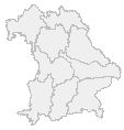
- Karte: Bayern
Oberes Grundwasser-Stockwerk
Grundwasserstände und Quellschüttungen vom:
| Messstelle | Lkr. | Grundwasserleiter | Datum | Grundwasserstand [m ü. NN] | Grundwasserstand [m u. Gelände] | Situation |
|---|---|---|---|---|---|---|
 ARZBACH 246C ARZBACH 246C | TÖL | Quartär | 18.03.2025 | 660,09 | 6,31 | sehr niedrig |
| Ainring D 84 | BGL | Schotterflächen | 18.03.2025 | 428,20 | 6,08 | sehr niedrig |
| EBERSDORF/COB. (KMS 3) | CO | Burg- und Blasensandstein (Sandsteinkeuper) | 18.03.2025 | 311,47 | 20,97 | sehr niedrig |
| Messstelle | Lkr. | Grundwasserleiter | Datum | Quellschüttung [l/s] | Situation |
|---|---|---|---|---|---|
| Gräumwiesenquelle 9-5 | TIR | Kristallines Grundgebirge | 18.03.2025 | -- | neuer Niedrigstwert |
| Weissbrunnen | KC | Unterer Muschelkalk | 18.03.2025 | 5,46 | sehr niedrig |
| Schlosswaldquellen | BGL | Alpine Gesteine | 18.03.2025 | 4,47 | sehr niedrig |
© Bayerisches Landesamt für Umwelt 2025